Terrain, Civil Engineering
Characteristics
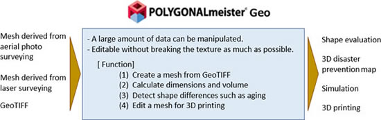
- A large amount of data can be manipulated.
- Edit the pasted texture so as not to break it as much as possible
Related functions
- Cleaning (Inspect and repair incorrect parts of the mesh.)
- Smoothing (Make smooth by removing fine irregularities on the surface of the mesh.)
- Simplify (Reduce the number of faces in the mesh.)
- Cut (Cut the mesh with a plane. You can remove one side of the cut or leave both sides.)
- Boolean Operation
- Scaling
- Move / Copy
- Drag Move (Shells can be moved along a straight line or on a plane by dragging.)
- Arrange Shells (Arrange shells according to various conditions.)
- Projection Solid (Sweep the open shell to a plane to create a solid shell.)
- Difference Solid (The difference between the mesh and the external file’s mesh is created as solid shells.)
- Transfer Color (Pastes the mesh color of the external file into the (working) mesh as a texture. )
- Segmentation (Divide the mesh into multiple color-coded areas based on shape feature.)
- Edit Segment Boundary (Merge segments, or smooth a segment boundary.)
- Terrain Meshing (Read the Geographic Information (GeoTIFF) file and create a mesh that reflects the written geographic information. )
- Display Contour Lines
- Soil / Space Volume (Displays the amount of soil volume or space volume (volume required to fill the soil) in the specified area.)
- Dekigata Heat Map (Display the height difference between the specified area and the mesh of the external file with a heat map.)
Case study
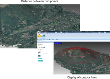
[ Calculation of distance and display of contour lines ]
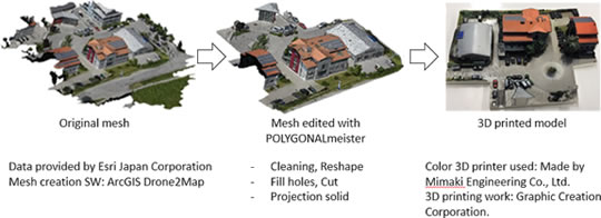
Edit mesh for 3D printing
Example1: 3D printing from mesh derived from drone photogrammetry
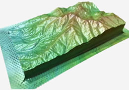
Example2: 3D panel
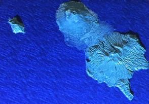
POLYGONALmeister Geo was used to manufacture "Noboyama Series NO.60 Hachijojima“ (Mountain three-dimensional panel "Bum Panel").
Example3: Island model
Modeling cooperation: Marubeni Information Systems
3D Printer: Stratasys J750
Corrosion analysis
A part of plant equipment that has been exposed to wind and rain for many years. There are places where the iron plate has become thin due to corrosion. An example in which the degree of corrosion cannot be measured because there is no CAD data before corrosion.
The shape without unevenness is estimated from the mesh derived from the measurement, and the corroded part and the amount of corrosion are displayed in a color map.
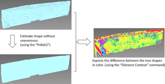
Data provided by SEIKOWAVE Inc.